Gallic War maps

Map: Helvetiorum Clades by A. Von Kampen

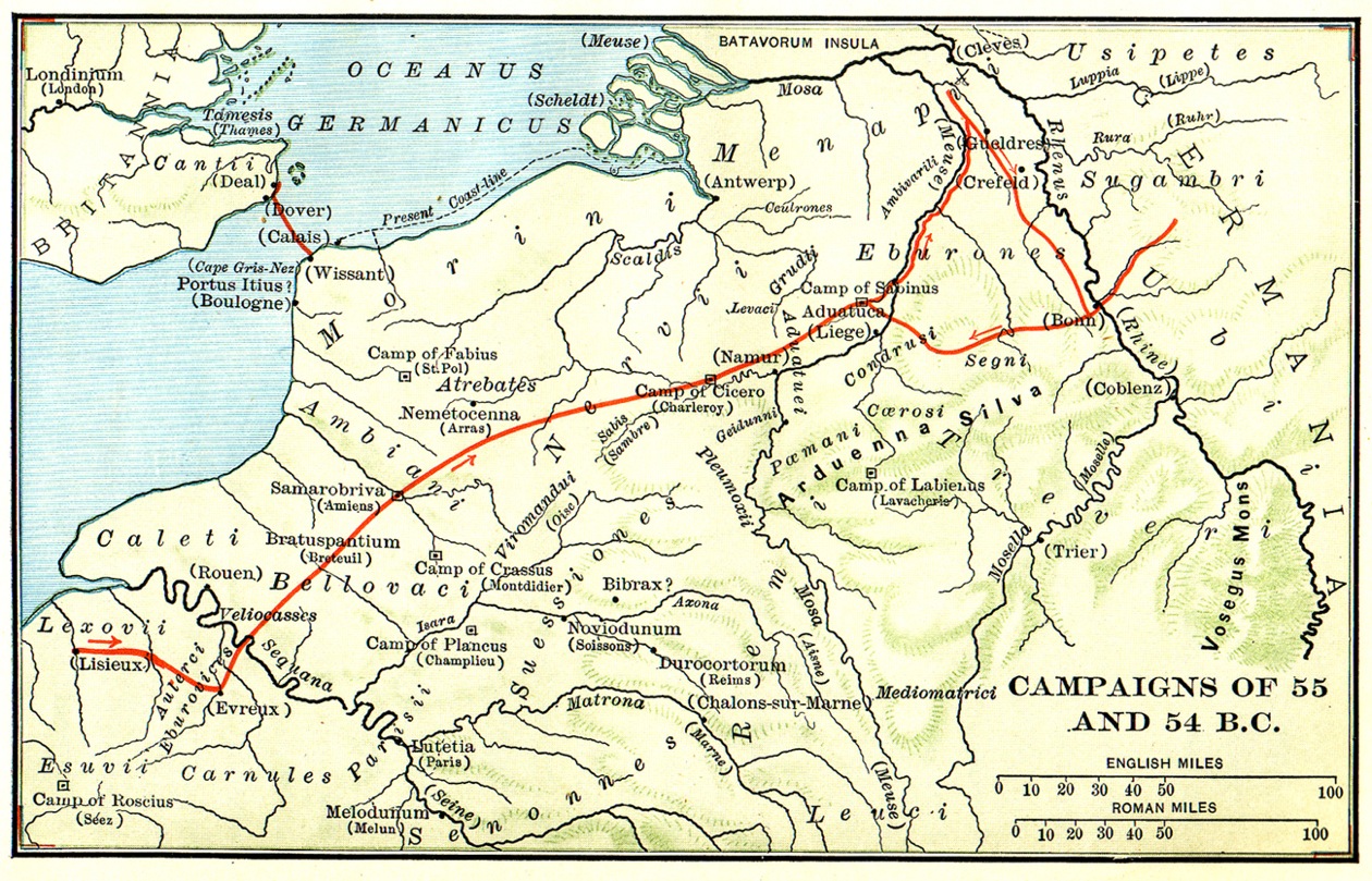
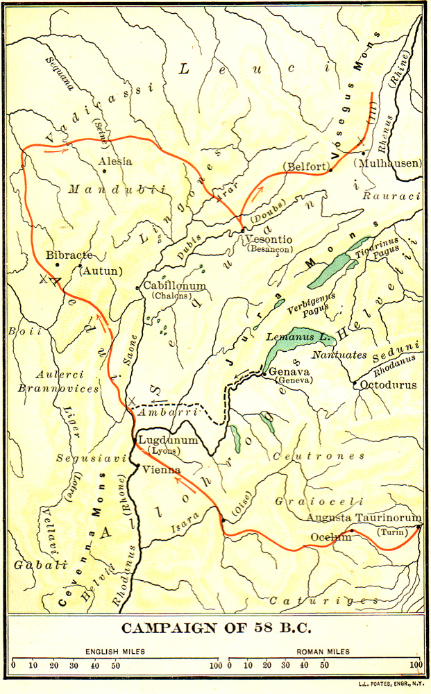
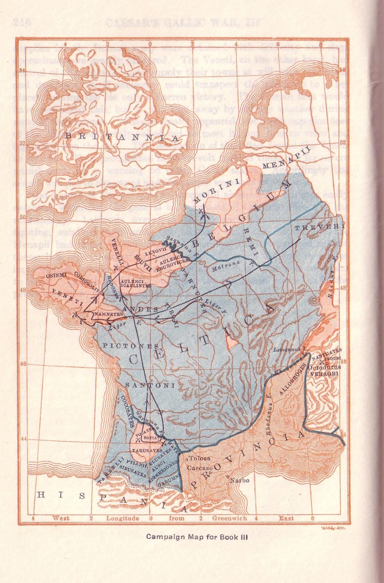
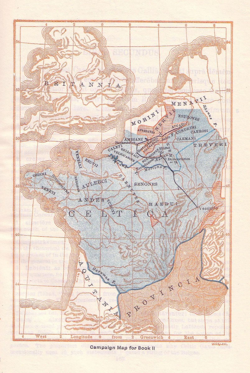
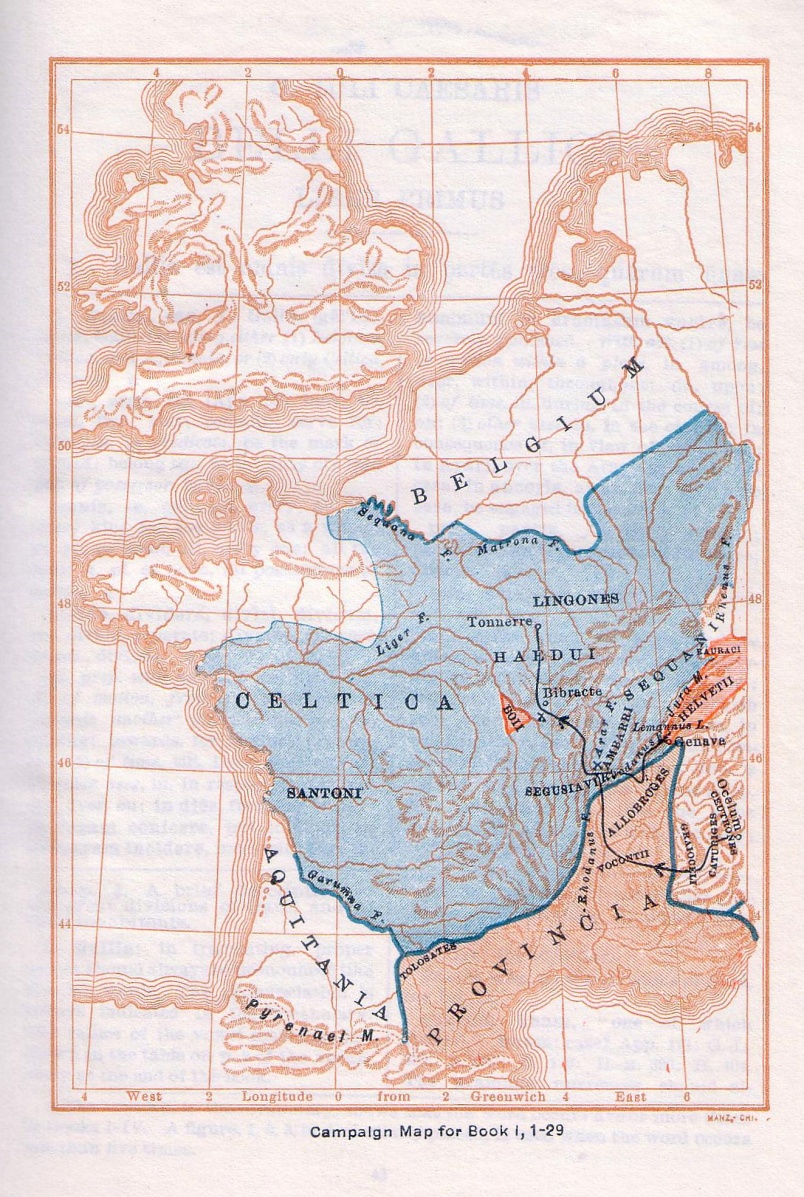
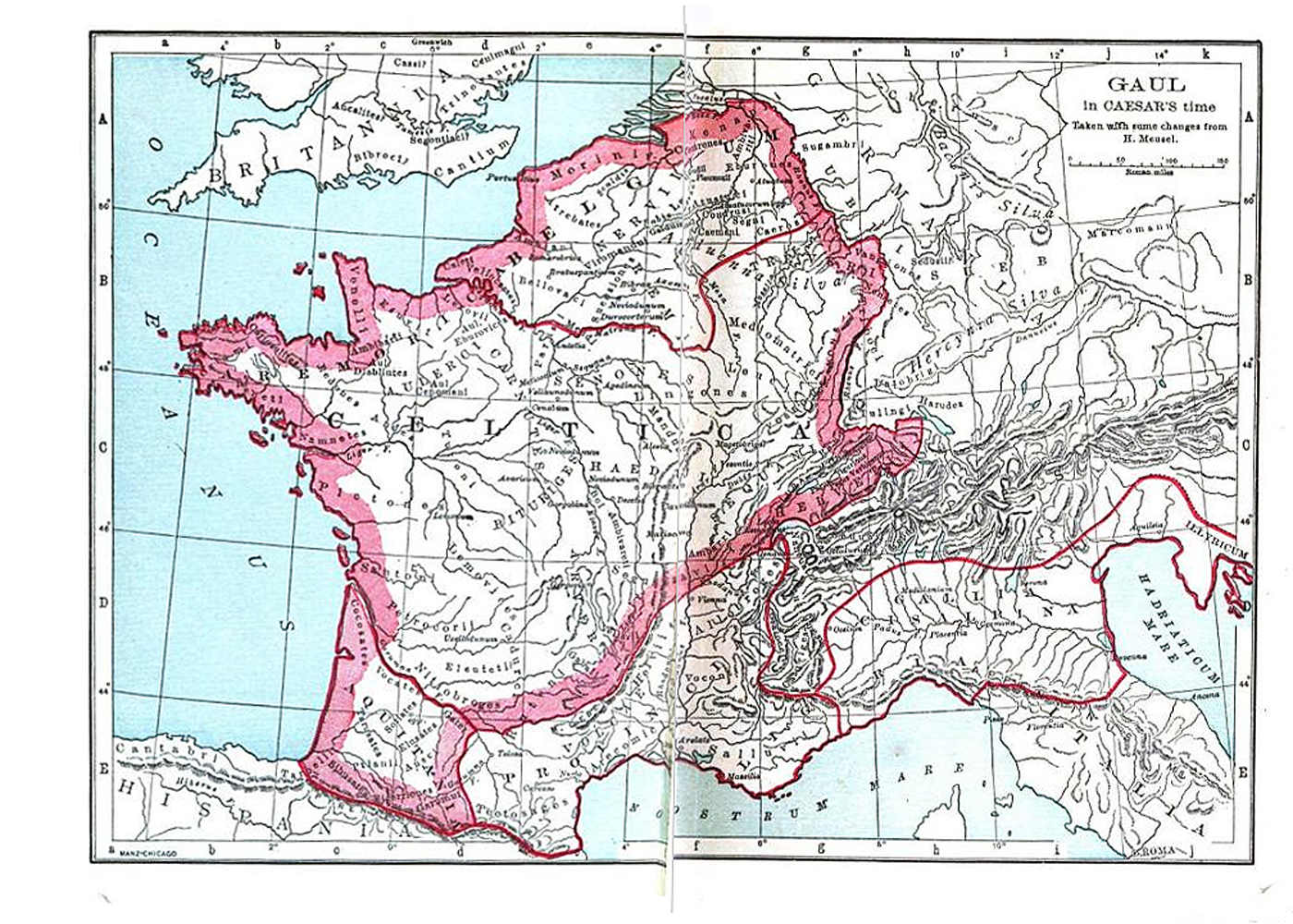
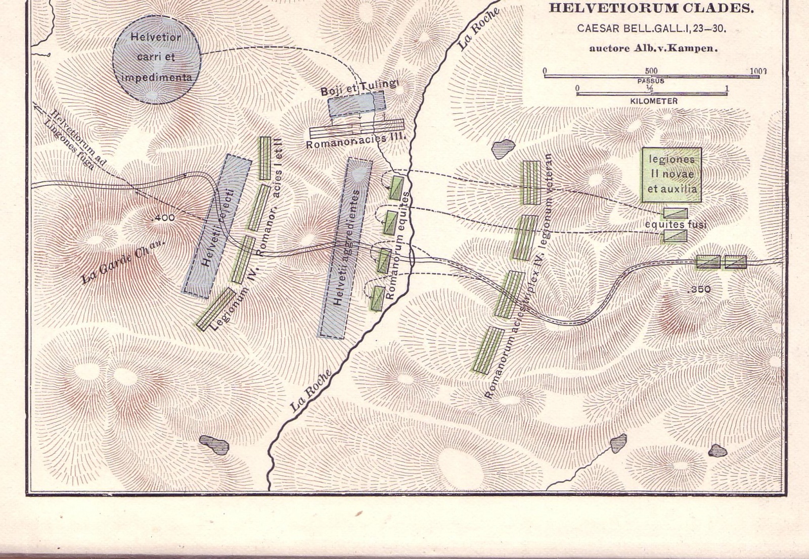
    Map of the battle against the Helvetii, (Caesar's Gallic War 1.23-26). From William Rainey Harper and Herbert Cushing Tolman, Eight Books of Caesar’s Gallic War (New York: American Book Company, 1891), p. 87. 

    Type
    Map
    License
    Creative Commons Attribution-ShareAlike
    Date
    1891
    article Nav

    Campaign Map of 55 and 54 BC by Towle & Jenks

      Map of the campaigns of the years 55 and 54 BC, during which Caesar led two expeditions to Britain, subdued the Treveri, and put down another Gallic revolt led by Ambiorix (Caesar's Gallic War Book 4, 5). From H.F. Towle and P.R. Jenks, Caesar’s Gallic War (Boston: D.C. Heath & Co., 1903), p. 76. 

      Type
      Map
      License
      Creative Commons Attribution-ShareAlike
      Date
      1903
      article Nav

      Map of Helvetia by Towle & Jenks

        Map of the territory of the Helvetii, who attempted to migrate to another land (Caesar's Gallic War 1.2). From H.F. Towle and P.R. Jenks, Caesar’s Gallic War (Boston: D.C. Heath & Co., 1903), p. 16. 

        Associated Passages
        Type
        Map
        License
        Creative Commons Attribution-ShareAlike
        Date
        1903
        article Nav

        Campaign Map of 58 BC by Towle & Jenks

          Map of the events of 58 BC, during which Caesar stopped the Helvetian migration and beat Ariovistus and the Germans (Caesar's Gallic War Book 1). From H.F. Towle and P.R. Jenks, Caesar’s Gallic War (Boston: D.C. Heath & Co., 1903), p. 1. 

          Associated Passages
          Type
          Map
          License
          Creative Commons Attribution-ShareAlike
          Date
          1903
          article Nav

          Map of Gaul by Towle & Jenks

            Map of Gaul at the time of Caesar's consulship, showing locations of peoples and tribes (Caesar's Gallic War 1.1). From H.F. Towle and P.R. Jenks, Caesar’s Gallic War (Boston: D.C. Heath & Co., 1903), p. vii. 

            Associated Passages
            Type
            Map
            License
            Creative Commons Attribution-ShareAlike
            Date
            1903
            article Nav

            Campaign Map for Book 4 by Arthur Tappan Walker

              Map of the arena of the first expedition to Britain and a campaign against the Germans (Caesar's Gallic War Book 4). Brown shows territory that was already under Roman control when Caesar received the province, red states that Caesar conquered, and blue state that submitted to Caesar without fighting. From Arthur Tappan Walker, Caesar's Gallic War (Chicago: Scott, Foresman and Co. 1907), p. 254. 

              Type
              Map
              License
              Creative Commons Attribution-ShareAlike
              Date
              1907
              article Nav

              Campaign Map for Book 3 by Arthur Tappan Walker

                Map of the arena of the campaigns through the Alps, in Aquitania, and against the Veneti (Caesar's Gallic War Book 3). Brown shows territory that was already under Roman control when Caesar received the province, red states that Caesar conquered, and blue state that submitted to Caesar without fighting. From Arthur Tappan Walker, Caesar's Gallic War (Chicago: Scott, Foresman and Co. 1907), p. 217. 

                Type
                Map
                License
                Creative Commons Attribution-ShareAlike
                Date
                1907
                article Nav

                Campaign Map for Book 2 by Arthur Tappan Walker

                  Map of the arena of the campaign against the Belgae. Brown shows territory that was already under Roman control when Caesar received the province, red states that Caesar conquered, and blue state that submitted to Caesar without fighting (Caesar's Gallic War Book 2). From Arthur Tappan Walker, Caesar's Gallic War (Chicago: Scott, Foresman and Co. 1907), p. 162. 

                  Type
                  Map
                  License
                  Creative Commons Attribution-ShareAlike
                  Date
                  1907
                  article Nav

                  Campaign Map for Book 1.1-29 by Arthur Tappan Walker

                    Map of the events of the campaign against the Helvetii. Brown shows the part of Gaul already under Roman control when Caesar received the province, red the states that Caesar conquered, blue the states that submitted without fighting (Caesar's Gallic War 1.1-29). From Arthur Tappan Walker, Caesar's Gallic War (Chicago: Scott, Foresman and Co. 1907), p. 42. 

                    Associated Passages
                    Type
                    Map
                    License
                    Creative Commons Attribution-ShareAlike
                    Date
                    1907
                    article Nav

                    Map of Gaul in Caesar's Time by H. Meusel

                      Map of Gaul at the time of Caesar's consulship, showing locations of peoples and regions (Caesar's Gallic War 1.1). From Arthur Tappan Walker, Caesar's Gallic War (Chicago: Scott, Foresman and Co. 1907), frontispiece. 

                      Associated Passages
                      Type
                      Map
                      License
                      Creative Commons Attribution-ShareAlike
                      Agent
                      Date
                      1907
                      article Nav
                      Subscribe to Gallic War maps