BG 4

Campaign Map of 55 and 54 BC by Towle & Jenks

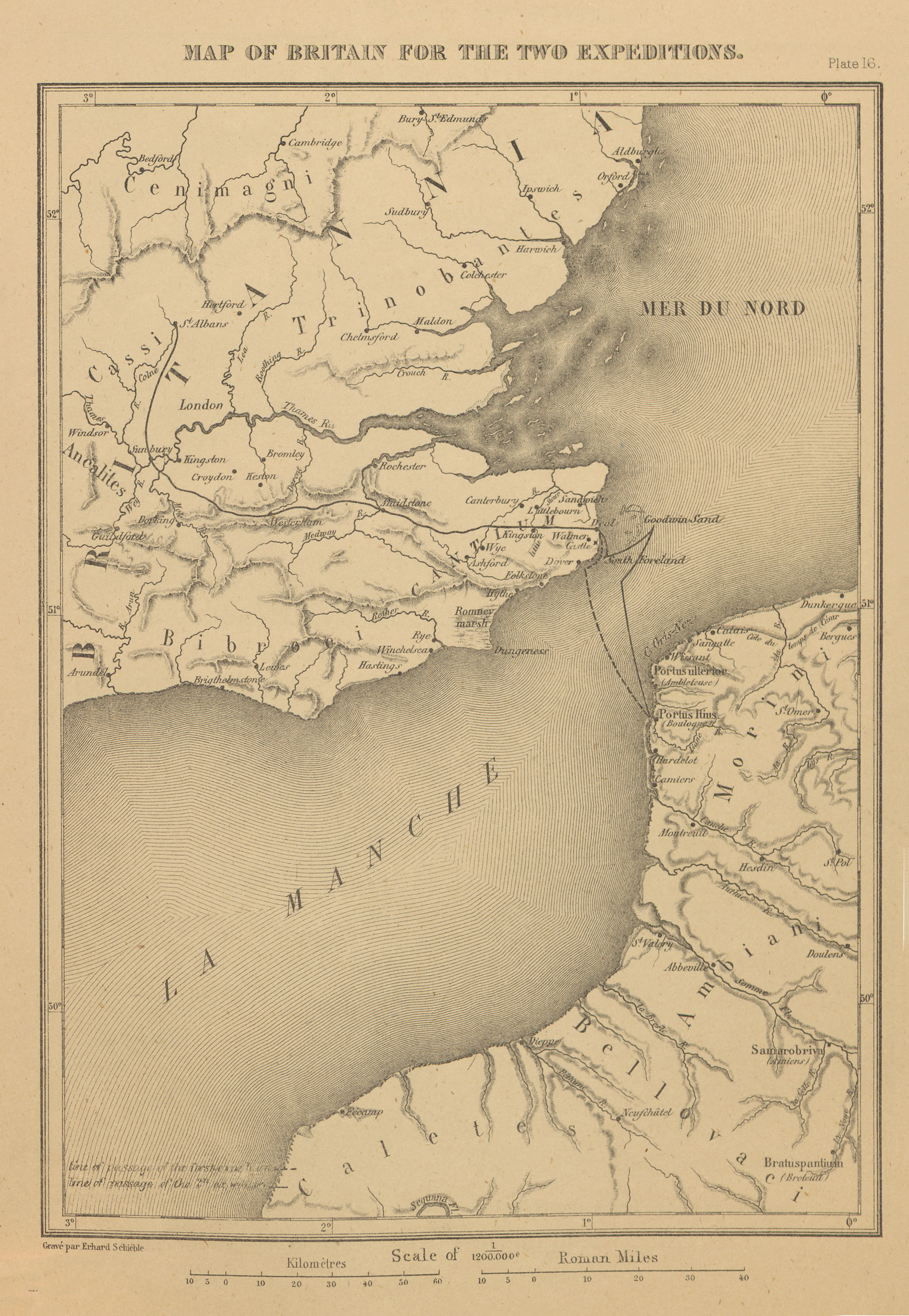
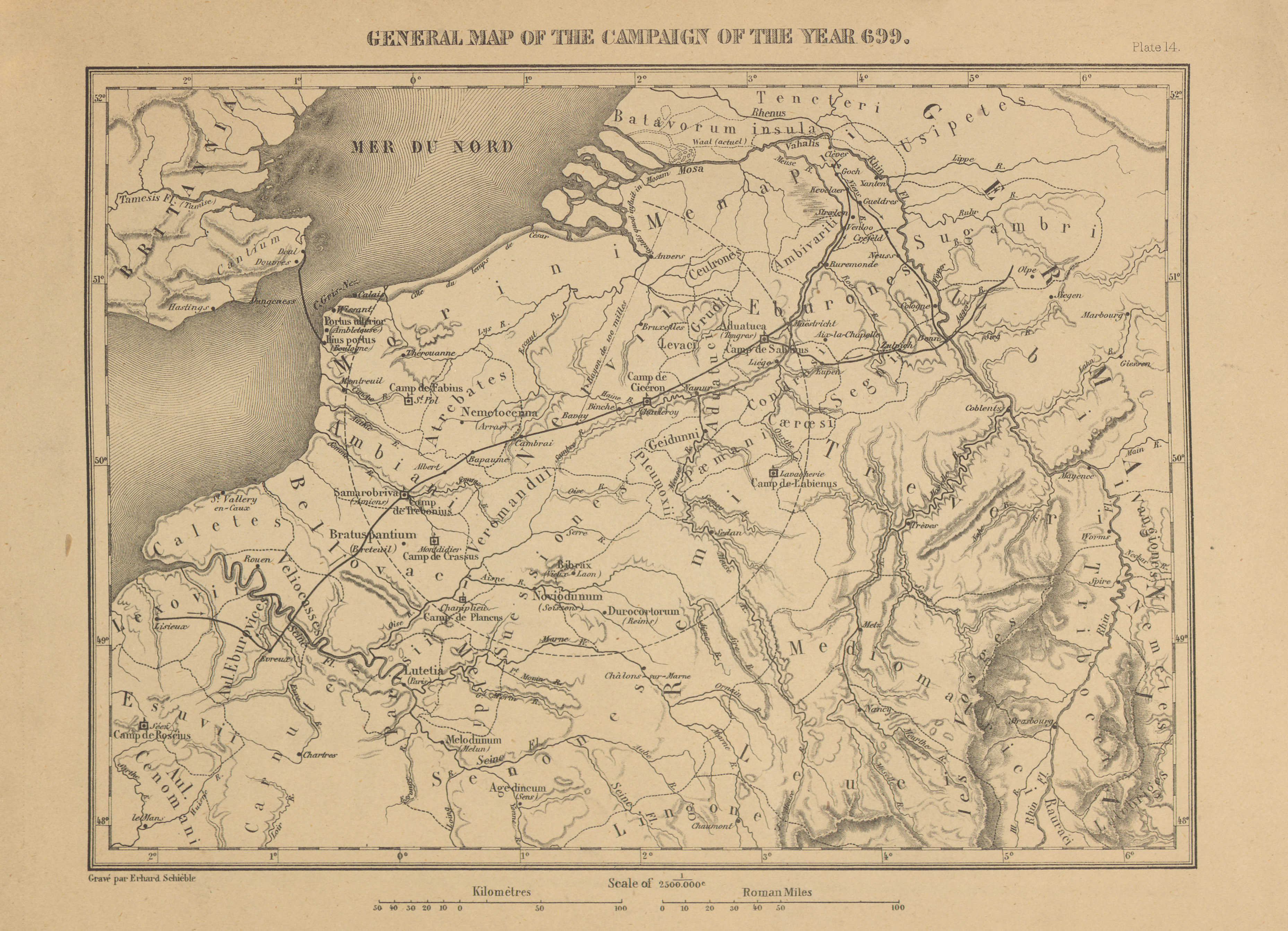
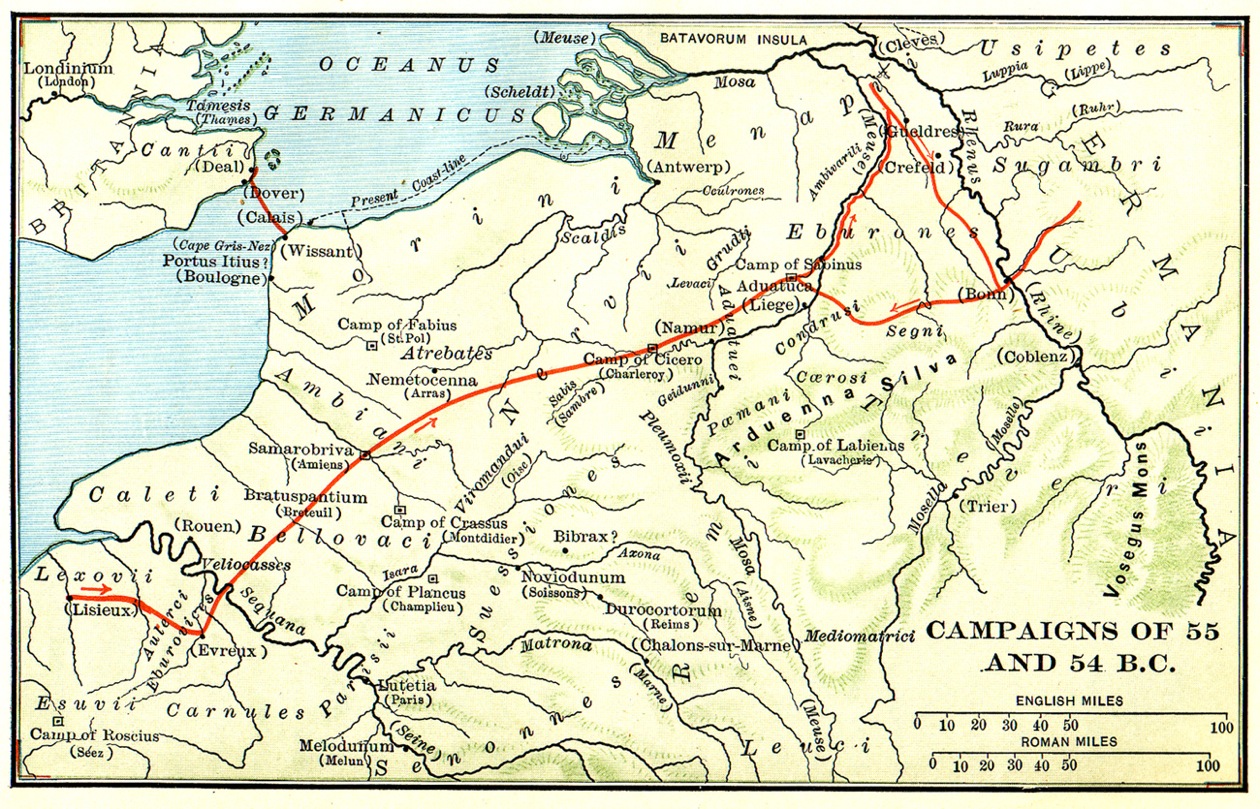
    Map of the campaigns of the years 55 and 54 BC, during which Caesar led two expeditions to Britain, subdued the Treveri, and put down another Gallic revolt led by Ambiorix (Caesar's Gallic War Book 4, 5). From H.F. Towle and P.R. Jenks, Caesar’s Gallic War (Boston: D.C. Heath & Co., 1903), p. 76. 

    Type
    Map
    License
    Creative Commons Attribution-ShareAlike
    Date
    1903
    article Nav

    Campaign Map for Book 4 by Arthur Tappan Walker

      Map of the arena of the first expedition to Britain and a campaign against the Germans (Caesar's Gallic War Book 4). Brown shows territory that was already under Roman control when Caesar received the province, red states that Caesar conquered, and blue state that submitted to Caesar without fighting. From Arthur Tappan Walker, Caesar's Gallic War (Chicago: Scott, Foresman and Co. 1907), p. 254. 

      Type
      Map
      License
      Creative Commons Attribution-ShareAlike
      Date
      1907
      article Nav

      Map: Britain for the Two Expeditions by Eugene Stoffel

        Map of the English Channel and Britain which Caesar crossed twice (Caesar's Gallic War 4.23, 5.8). From Napoleon III, History of Julius Caesar Volume 2 (New York: Harper & Brothers, 1866), plate 16.

        Type
        Map
        License
        Creative Commons Attribution-ShareAlike
        Date
        1866
        article Nav

        General Map of the Campaign of 54 BC by Eugene Stoffel

          Map of the arena of the campaign of 54 BC, which included a German invasion into, the Romans' first crossing of the Rhine, and the first expedition to Britain (Caesar's Gallic War Book 4). From Napoleon III, History of Julius Caesar Volume 2 (New York: Harper & Brothers, 1866), plate 14.

          Type
          Map
          License
          Creative Commons Attribution-ShareAlike
          Date
          1866
          article Nav
          Prenumerera på BG 4